Best Places to Visit in Uttarakhand (2026): Temples, Treks and Hill Towns
15 best places to visit in Uttarakhand in 2026, from Rishikesh rapids to Auli snow, with honest tips on when to go and what to skip.
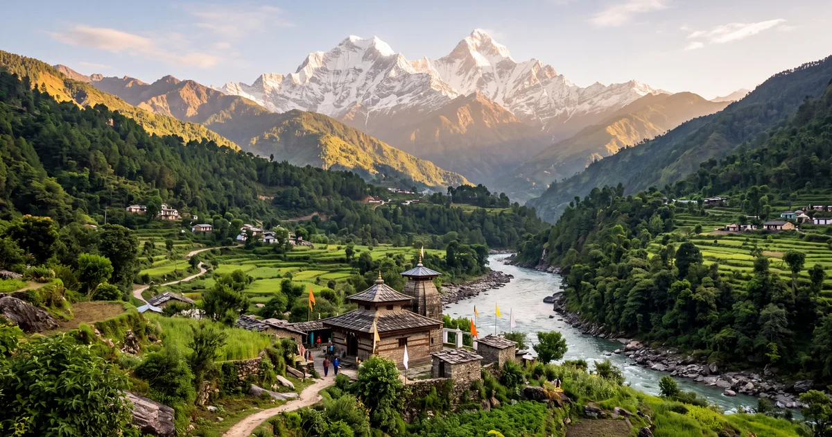
Uttarakhand covers 53,483 square kilometres of Himalayan terrain, and about half of that is forest. The state stretches from the Terai plains at 200 metres elevation to Nanda Devi at 7,816 metres. Between those extremes sit river towns, pilgrim routes older than most countries, alpine meadows that bloom for eight weeks a year, and ski slopes that get 3 metres of snow by January.
I have lost count of how many times I have taken the Dehradun highway from Delhi. The first time was a student trip to Rishikesh. The last was a winter Kedarkantha trek where the summit temperature hit minus 12°C. Every trip taught me something the guidebooks leave out: which roads close without warning, which "scenic viewpoints" are just parking lots, and which small towns are better than the famous ones.
This is what I would tell a friend planning their first Uttarakhand trip.
TL;DR
- Rishikesh and Mussoorie are the easiest first trips from Delhi (5 to 6 hours by road).
- October and November give the clearest Himalayan views. March to June works for hill stations.
- Auli is India's most underrated ski destination. Season runs December to February.
- Valley of Flowers opens mid July to mid September. Go in August for peak bloom.
- Budget 5 days minimum. 7 to 10 days if you want treks or Char Dham.
Where Should You Start If You Have Never Been to Uttarakhand?
Rishikesh. No debate. The town sits at the point where the Ganges leaves the mountains and enters the plains. That geography gives it Class III and IV rapids (September and October are the best months for rafting), a 400 metre zip line at Shivpuri, and riverside camping spots 13 km upstream from the main town.
Ram Jhula and Laxman Jhula are the two iron suspension bridges everyone photographs. Laxman Jhula was closed in 2020 due to structural damage, but the replacement bridge opened in 2023. The Beatles Ashram (Maharishi Mahesh Yogi's abandoned retreat) charges ₹150 entry and takes 90 minutes to explore properly.
One thing most people get wrong: Rishikesh is not a hill station. Elevation is only 372 metres. It gets hot from April to June (38°C is common). Visit in October when the air is crisp, the monsoon swell makes the rapids intense, and the beaches along the Ganges are clean.
For rafting, camping, and group trips in Uttarakhand, operators typically bundle 2 nights of riverside camping with a half day raft.
Is Mussoorie Still Worth Visiting in 2026?
Yes, but only if you go beyond Mall Road. Mussoorie sits at 2,005 metres and gets 2 million visitors annually. Most of them walk the same 1 km stretch of Mall Road, eat maggi at a bench, and leave.
The real Mussoorie is elsewhere. Landour, the old British cantonment 300 metres above the main town, has Char Dukan (four bakeries from the 1940s that still serve peanut butter toast and black coffee). Sister's Bazaar has a bakery run by a Tibetan family that bakes the best walnut cake in Uttarakhand. George Everest's house (the Surveyor General after whom the mountain was named) is a 6 km walk from Library Point with views of the Doon Valley and the Yamuna bend.
The caveat: Mussoorie is unbearable on Saturday evenings from April to June. Traffic backs up 5 km on the Dehradun road. If you are driving up for a weekend getaway from Delhi, leave before 5 AM Friday or wait until a weekday in October.
Kempty Falls (15 km from town) is listed in every guide. I would skip it. The waterfall itself is 12 metres tall, but the area around it is cemented, overcrowded, and smells of garbage. Spend that time at Benog Tibba instead. The 7 km forest walk from Mussoorie Library takes you through oak and deodar forest to a ridge with views of Bandarpoonch (6,316 metres).
What Makes Nainital Different from Other Uttarakhand Hill Stations?
The lake. Naini Lake is a crescent shaped water body at 1,938 metres, 1.4 km long and 400 metres wide. Rowing boats cost ₹200 for 30 minutes. Pedal boats cost ₹250. The Naina Devi temple at the northern shore has been here since the 15th century (rebuilt after a 1880 landslide destroyed the original).
Mall Road runs along the lake's east bank. It is the social spine of the town: restaurants, shops, the Flats (a wide section where families gather in the evening), and the boat club. Walk along it once at sunset for the reflection of Naina Peak in the water.
Tiffin Top is a 4 km trek from Ayarpatta. It gives you a 360 degree view of the Kumaon hills and the plains below. On clear November mornings, you can see Nanda Devi 120 km away. The trek takes 2 hours round trip and is doable in regular shoes.
My honest opinion: Nainital is better in winter than summer. November through February, the crowds thin by 60%, snow sometimes dusts the peaks around the lake, and hotel rates drop. The downside is that the lake water level drops by January, so the boats might not run in a dry year.
How Good Is the Skiing at Auli?
Auli has India's longest cable car (4 km, from Joshimath to Auli at 2,915 metres), a 500 metre ski slope maintained by GMVN, and views of Nanda Devi, Kamet, and Mana Peak. The skiing season runs December to February. Equipment rental costs around ₹500 per day. A 5 day beginner ski course through GMVN costs approximately ₹12,000 including accommodation.
The slope is not Gulmarg. It is shorter, less steep, and the infrastructure is basic. But it is significantly cheaper, less crowded, and the panorama of the Nanda Devi range from the top of the slope is arguably better than anything in Kashmir.
Getting there is the catch. Joshimath is 270 km from Rishikesh (10 hours by road on a good day). The road via Devprayag, Rudraprayag, and Karnaprayag follows the Alaknanda river through gorges and is one of the most scenic drives in India. It is also one of the most landslide prone, especially during and just after monsoon.
If you are considering a winter trip, check Himalayan trek options for group departures that include Auli and nearby Kuari Pass.
When Does Valley of Flowers Actually Bloom?
Mid July to mid September. The national park opens in June, but the real bloom peaks in the last two weeks of July and the first two weeks of August. The valley floor sits between 3,250 and 3,658 metres and holds over 600 species of flowering plants. Brahmakamal, blue poppy, cobra lily, and dozens of orchid varieties carpet the 87 square kilometre area.
The 17 km trek from Govindghat to Ghangaria (the base village) takes 6 to 7 hours. Ghangaria has basic guesthouses (₹500 to ₹1,500 per night) and a GMVN lodge. From Ghangaria, the Valley of Flowers is a 4 km walk, and Hemkund Sahib (a Sikh shrine at 4,329 metres beside a glacial lake) is a separate 6 km climb.
Carry a rain jacket. It rains every afternoon during bloom season. The trail from Govindghat gets muddy, and mule traffic churns it into slush. Wear waterproof trekking shoes, not sneakers.
One thing that surprised me: the valley is quieter than expected. Most visitors do Hemkund Sahib and skip the flowers. On a weekday in early August, you might share the valley with 30 to 40 people, mostly botanists and photographers.
Chopta and Tungnath: Is It Really the Easiest Himalayan Trek?
Yes, with a qualifier. The trek from Chopta to Tungnath temple (the highest Shiva temple in the world at 3,680 metres) is 3.5 km one way. The path is paved with stone steps for most of the distance. A reasonably fit person can do it in 2 to 2.5 hours. From Tungnath, the Chandrashila summit (4,000 metres) is another 1.5 km.
The qualifier: "easy" assumes clear weather. In winter (December to February), the trail is covered in 2 to 3 feet of snow. You need microspikes, warm layers, and ideally a guide. In monsoon, the stone steps get slippery and visibility drops to 10 metres in fog.
Chopta itself is a small meadow at 2,680 metres on the Gopeshwar road. There is no town, just a few dhabas and tent accommodations. The drive from Rishikesh takes 8 hours (200 km). Come in late September or October for golden oak forests and clear summit views of Nanda Devi, Trishul, and Chaukhamba.
What About Kedarnath and the Char Dham?
The Char Dham (Kedarnath, Badrinath, Gangotri, Yamunotri) is one of the most important Hindu pilgrimages in India. Kedarnath alone draws over 1 million pilgrims between May and October. The 16 km trek from Gaurikund to the temple at 3,583 metres is steep, crowded during peak season, and takes 6 to 8 hours one way. Pony rides cost ₹3,000 to ₹5,000 depending on season. Helicopter services (₹7,000 to ₹9,000 one way) operate weather permitting.
Badrinath is accessible by road (297 km from Rishikesh, 10 to 12 hours). The temple at 3,133 metres sits in a narrow valley between Nar and Narayana peaks. The Tapt Kund hot spring near the temple is genuinely warm (45°C) even when the outside temperature is 5°C.
My suggestion: if you are not doing the full Char Dham circuit, pick Kedarnath or Badrinath individually. Trying to rush all four in 8 days (as some tour packages promise) means spending most of your time in a car on winding mountain roads. The Char Dham highway improvements have cut drive times, but the journey is still exhausting.
For organized group trips that handle the logistics, operators typically run 10 to 12 day Char Dham circuits with built in rest days.
Which Lesser Known Places Are Worth the Extra Effort?
Munsiyari sits at 2,298 metres in the Pithoragarh district, facing the Panchachuli peaks (five summits between 6,334 and 6,904 metres). The town gets a fraction of Nainital's visitors. The Khaliya Top trek (10 km round trip) offers one of the best Himalayan panoramas in Kumaon. The drive from Kathgodam takes 10 hours, which keeps the crowds away.
Binsar is a wildlife sanctuary 33 km from Almora. The KMVN guesthouse at 2,420 metres has a terrace facing a 300 km stretch of the Himalayan range: Kedarnath, Chaukhamba, Trishul, Nanda Devi, Nanda Kot, and Panchachuli in one sweep. Come in November when the rhododendrons are bare and the views are unobstructed.
Chakrata (92 km from Dehradun, 3 hours) is an army cantonment town at 2,118 metres. Tiger Falls (a 50 metre cascade in a forested ravine) is a 5 km hike from the road. The town has no mall road, no souvenir shops, and no weekend traffic. That is the point.
Pithoragarh is the district headquarters near the Nepal border. The town itself is unremarkable, but it is the base for treks to Milam Glacier, Ralam Glacier, and the Darma Valley. These are multi day treks (5 to 8 days) through valleys that see fewer than 500 trekkers a year.
How Do I Plan a Budget Uttarakhand Trip?
Transport is the biggest variable. Delhi to Dehradun by Shatabdi train costs ₹560 for AC Chair. Delhi to Kathgodam (for Nainital) by Ranikhet Express costs ₹385 in Sleeper. Buses from ISBT Kashmere Gate run to Rishikesh (₹350, 6 hours), Mussoorie (₹500, 7 hours), and Nainital (₹600, 8 hours).
Accommodation in hill stations ranges from ₹600 per night (basic guesthouse in Mussoorie offseason) to ₹3,000 (mid range hotel in Nainital during Diwali week). GMVN rest houses in places like Chopta, Auli, and Joshimath are reliable budget options (₹800 to ₹1,500).
Food is inexpensive outside tourist traps. A thali at a local dhaba costs ₹100 to ₹150. Maggi at a trek stop costs ₹50. Mall Road restaurants in Mussoorie and Nainital charge 2x to 3x dhaba prices for the same food with a view.
A 5 day Rishikesh plus Mussoorie trip can cost ₹8,000 to ₹12,000 per person including transport, stays, and food (excluding rafting, which adds ₹1,500 to ₹2,500). Browse current group trip prices for bundled options that include transport, meals, and activities.
What Are the Roads Like in Uttarakhand?
This matters more than most guides admit. The state has beautiful roads and terrible roads, sometimes on the same route.
NH 7 (Dehradun to Badrinath highway) is well maintained until Joshimath. Beyond Joshimath, landslide repairs and single lane sections slow traffic. The Char Dham highway project has widened major sections, but construction zones still cause 1 to 2 hour delays at multiple points.
The Rishikesh to Chopta road via Ukhimath is narrow, poorly lit, and runs along cliff edges with no guardrails for stretches. Do not drive it at night.
Nainital is connected by a good two lane road from Kathgodam (35 km). The approach gets jammed on weekends. The Haldwani bypass has reduced some traffic since 2024.
Monsoon (July to September) is the worst time for road travel. Landslides block the Badrinath highway 3 to 5 times per season. The Kedarnath route via Gaurikund gets rain damage annually. If you are visiting during monsoon, stick to lower altitude destinations like Rishikesh, Dehradun, and Lansdowne.
Honest advice: if a hill road scares you, do not push through. Turn back and find an alternate route or wait. The mountains do not care about your itinerary.
The State by Season: A Quick Reference
March to June (summer): Hill stations at their best. Mussoorie, Nainital, Almora, and Ranikhet are pleasant (15 to 25°C). Rishikesh gets hot. High altitude treks to Kedarkantha, Roopkund, and Brahmatal open after snow melts.
July to September (monsoon): Valley of Flowers peaks. Rishikesh rafting season starts in September. Roads are risky. Waterfalls are spectacular. The landscape is greenest you will ever see it. Travel insurance is a good idea.
October to November (post monsoon): The best window for photography and Himalayan views. Clear skies, moderate temperatures, thin crowds. Chopta, Binsar, and Munsiyari are at their finest. The Nanda Devi range looks close enough to touch on November mornings.
December to February (winter): Auli skiing. Kedarkantha snow trek. Chopta Tungnath winter trek. Hill stations are cold (below 0°C at night in Mussoorie). Hotels are cheap. If you want snow, this is your season.
Uttarakhand is not one destination. It is a state with at least 10 distinct travel personalities, and the one you encounter depends entirely on where you go and when. Start with Rishikesh or Mussoorie if you are new. Save the deep Garhwal and Kumaon valleys for your second or third trip, when you know what kind of mountain experience you are after.
Explore Uttarakhand trip options or browse all group departures to find something that fits your dates.
Frequently asked questions
- What are the top 5 must visit places in Uttarakhand?
- Rishikesh for rafting and riverside camping, Mussoorie for a quick hill station escape from Delhi, Nainital for the lake and Naina Devi temple, Auli for winter skiing and Himalayan views, and Valley of Flowers for the July to September bloom. These five cover adventure, pilgrimage, and scenery without needing more than 10 days.
- How many days are enough for an Uttarakhand trip?
- A 5 day trip covers Rishikesh and Mussoorie comfortably. For Kedarkantha or Valley of Flowers, plan 7 days including travel from Delhi. A full Char Dham yatra needs 10 to 12 days by road. Most group departures run 4 to 7 day itineraries covering two or three destinations.
- What is the best time to visit Uttarakhand?
- March to June for hill stations and summer treks. July to September for Valley of Flowers, monsoon waterfalls, and lower Garhwal greenery (but roads get risky). October to November for clear Himalayan views and post monsoon trekking. December to February for snow, skiing at Auli, and the Chopta Tungnath winter trek.
- Is Uttarakhand safe for solo female travellers?
- Broadly yes, especially in tourist towns like Rishikesh, Mussoorie, and Nainital where infrastructure and police presence are decent. Remote treks like Roopkund or Pindari glacier are safer with a group or registered guide. Avoid hitchhiking on hill roads after dark. Most group trek operators run women only batches during peak season.
- How do I reach Uttarakhand from Delhi?
- Dehradun is the main gateway: 5.5 to 6 hours by car (250 km via NH 44/NH 7), 5.5 hours by Shatabdi train, or a 1 hour flight to Jolly Grant airport. Kathgodam station near Nainital is 6 hours by Ranikhet Express. Rishikesh is 230 km (5 hours) by road from Delhi. Most group trips arrange transport from Delhi or Dehradun.
- What should I skip in Uttarakhand?
- Skip Mussoorie's Mall Road on weekends (overcrowded and overpriced), the Kempty Falls tourist trap (dirty, commercialized), and the Land's End viewpoint in Nainital (underwhelming for the effort). Avoid driving the Char Dham highway during heavy monsoon in July and August unless you are comfortable with landslide delays.
- Can I visit Char Dham in 2026?
- Yes. The Char Dham highway project has shortened road travel times significantly. Kedarnath, Badrinath, Gangotri, and Yamunotri temples open from late April or early May through October/November (dates vary by temple). Helicopter services run to Kedarnath (₹7,000 to ₹9,000 one way) for those who cannot do the 16 km trek.